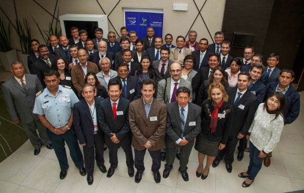
South America is anticipating natural disasters by planning for them. On June 2 and 3, 2016, the Executive Technical Group Meeting on Disaster Risk Management (link in Spanish) took place in Lima, Peru, as part of the COSIPLAN/IIRSA Work Plan, which is coordinated by INTAL. The meeting was attended by delegations from Argentina, Chile, Colombia, Ecuador, Peru, Uruguay, and Venezuela and representatives from the General Secretariat of UNASUR and the IIRSA Technical Coordination Committee. Also present were representatives from research centers in Chile and Peru and consultants who specialize in this field.
Pilot Study on Disaster Risk Management in Chile and Peru
The COSIPLAN countries have developed a Methodology for Incorporating Disaster Risk Management (DRM) into Integration Infrastructure. The initiative is being coordinated by Chile and is receiving technical support from the IDB. Chile and Peru have complete a pilot project for this methodology in an area that is at risk from seismic activity and tsunamis. During the first day of the meeting, the results of the pilot project and the lessons learned from it were shared with the other UNASUR countries[1].
The five key points from the discussion of the methodology and the two countries’ experiences applying it are as follows:
- The lack of specific information is a limiting factor, so on-the-ground information that would allow the methodology to be applied needs to be created or adapted. One alternative would be to take a deterministic approach as such methodologies could be applied locally and would generate the necessary information to bridge this gap.
- Infrastructure is increasingly operated by public–private partnerships. For this reason, infrastructure concession agreements should specify the level of risk that is acceptable to the state so as to guarantee that the infrastructure will function in the event of a disaster.
- Including the benefits of risk mitigation in the social and economic assessment stage of integration projects is fundamental, given how vulnerable infrastructure is when these events strike.
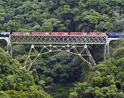
- The object of analysis for the methodology are the territories where projects from the COSIPLAN Project Portfolio are being developed. The methodology can be applied to evaluate different types of threats, countries, and infrastructure, including logistic systems.
- The DRM Methodology achieved its objectives. It would be important to add it as a tool to the design of Territorial Integration Programs (PTIs), as happened with the Production Integration and Logistics (IPrLg) and Strategic Environmental and Social Evaluation (EASE) methodologies.
National Experiences that Enrich Regional Policies
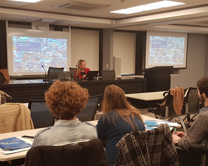
Over the course of the second day, the experiences of countries in the region were presented, with an emphasis on how they had prepared for and coped with different natural hazards.
![]() Argentina: handling of the flood-related emergency the country is currently experiencing (2015–2016) due to the effects of the El Niño phenomenon.
Argentina: handling of the flood-related emergency the country is currently experiencing (2015–2016) due to the effects of the El Niño phenomenon.
![]() Colombia: guidelines for risk management in rebuilding infrastructure, based on the flooding-related emergency caused by the La Niña phenomenon in 2010.
Colombia: guidelines for risk management in rebuilding infrastructure, based on the flooding-related emergency caused by the La Niña phenomenon in 2010.
![]() Chile: the experience of the Ministry of Public Works during the catastrophes of 2015, particularly in relation to the planning of the coastal area and protection infrastructure in response to the tsunamis and tidal surges that occurred that year.
Chile: the experience of the Ministry of Public Works during the catastrophes of 2015, particularly in relation to the planning of the coastal area and protection infrastructure in response to the tsunamis and tidal surges that occurred that year.
![]() Peru: prospective and corrective risk management components developed by the National Center for Estimates, Prevention, and Disaster Risk Reduction (CENEPRED) in the.
Peru: prospective and corrective risk management components developed by the National Center for Estimates, Prevention, and Disaster Risk Reduction (CENEPRED) in the.
Particularly important was the perspective of two research centers in the region: Chile’s National Research Center for Integrated Natural Disaster Management (CIGIDEN) and Peru’s Japanese-Peruvian Center of Seismic Investigations and Disaster Mitigation (CISMID). The most significant points they put forward were:
- There are simulation tools that predict the effects of a catastrophe on an urban area. These allow the user to measure not only the scale of the damage but also to design evacuation and emergency response tools.
- The traffic and evaluation routes selected for use in the event of a natural disaster need to be checked to ensure that their size and capacity would remain unchanged in an emergency of this type. This is due to the fact that the way public space is used on a daily basis could lead to such routes being blocked or limited, preventing them from being used as planned during an emergency.
- Breakthroughs in satellite data collection and classification have enabled experts to evaluate how earthquakes affect transportation routes with great precision.
Disaster Risk Management on the UNASUR/COSIPLAN Agenda
UNASUR’s High-Level Working Group on Comprehensive Disaster Risk Management (GTAN/GIRD) is a permanent space for coordinating the different Sector Council initiatives relating to this matter. The states present set the goal of working towards adopting common mechanisms and protocols that would enable efficient management of humanitarian aid in the event of a disaster and common risk reduction policies, strategies, and tools.
As part of this initiative, COSIPLAN will make its experience in risk management and infrastructure planning and its Geographic Information System available to the group in order to help establish a strategy to leverage disaster-related cooperation.
The main outcomes of the second day of the meeting are directly linked to UNASUR’s goal of building a coordinated common agenda:
- Promoting comprehensive disaster risk management in national and COSIPLAN planning processes as a defining feature of these. Among other things, this would allow the group to avoid building or redeveloping infrastructure or connectivity systems that are vulnerable to natural disasters.
- Systematically recording any action taken (i) during the planning process to incorporate comprehensive risk management; (ii) during the disaster itself to make infrastructure functional as quickly as possible; and (iii) during the reconstruction and redevelopment of affected infrastructure. The aim of these steps is to guarantee that such experience is transferable and to encourage the institutionalization and standardization of these mechanisms at the national and regional levels.
- Promoting mechanisms to include citizens in comprehensive disaster risk management within UNASUR.
- Given that climate change is exacerbating natural disasters in the region, analyzing whether this issue should be included in the COSIPLAN agenda as part of its approach to disaster risk management or in other areas.
[1] See INTAL Connection no. 235, March 2016 (link to the article)