Without infrastructure, development is not possible. Highways, roads, bridges, power stations, and better communication technology are all vital cogs in any productive system. Many projects extend across borders and thus require coordination and initiatives from several countries to be set in motion.
The 2016 Activities Report (link in Spanish) for , demonstrates the benefits of effective planning for regional infrastructure projects in South America and the advances that have been made in the areas of strategic integration transportation, energy, and communications works. Planning methodologies are designed and applied with the aim of building a more realistic view of the complexity of the dynamics on the ground.
This article summarizes the areas where significant progress was made in 2016, especially in relation to methodologies and tools for planning high-impact infrastructure for the region’s socio-economic development. Two other articles in this issue of INTAL Connection discuss COSIPLAN’s achievements in relation to integration projects and information technology.
One Hundred Initiatives to Strengthen The Agua Negra Binational Tunnel
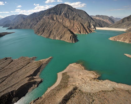
The Integration Territorial Program (PTI) for the Agua Negra Binational Tunnel is South America’s first experience in designing this type of approach. The objective of the project is to leverage the positive outcomes of constructing the tunnel and to mitigate or reduce factors that prevent people from fully taking advantage of these benefits.
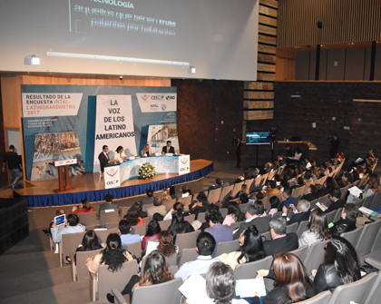
In 2016, teams from Argentina and Chile made headway on gathering information on the 100 actions and activities that had been designated as priorities in the PTI Implementation Plan. The PTI is divided into Strategic Areas and Cross-Cutting Factors to structure and organize the interventions needed in the Area of Direct Action for the tunnel. The First Workshop on the Implementation Plan (link in Spanish) took place on August 24 and 25, 2016, in Santiago de Chile, and was attended by approximately 70 high-level political and technical government officials from the two countries.
Over the course of the two-day workshop, the countries carried out collaborative work to consolidate the scope of the implementation plan and establish who is responsible for gathering information, managing, and following up on each of these actions and activities. In addition, new initiatives presented by the countries were discussed and it was agreed that regular online meetings would be held to follow up on the implementation of the actions in each area.
Integration in Times of Climate Change
Over the last 30 years, large-scale disasters have caused direct losses of US$16.5 billion to infrastructure in South America. The countries in the region are working together through COSIPLAN to manage disaster risk in relation to infrastructure using methodology that has already been applied in the seismic silence zone between Chile and Peru, with IDB financing.
The pilot application began in January 2015 and included integration infrastructure projects that are part of Project Group 5 of the Central Interoceanic Hub. Two integration infrastructure projects were selected in Chile (the port of Arica and Arica airport) and two in Peru (the port of Matarani and Tacna airport).
On March 8 and 9, 2016, the Chile and Peru Binational Workshop on Risk and Disaster Prevention Management (link in Spanish) took place at the University of Tarapacá. At the workshop, the results of the assessment study were presented and possible risk reduction measures were identified for the infrastructure in question. The Executive Technical Group Meeting (link in Spanish) was held in Lima on June 2 and 3, 2016. Those present discussed the outcomes of the pilot application of the methodology in Chile and Peru and other experiences in each country that may stimulate regional policies and leverage work that has already been carried out to prepare for and handle different natural hazards.
Regional Logistics to Improve Competitiveness
Modern freight logistics includes the movement of goods through space (transportation) and time (storage and warehousing, stocktaking). The exponential growth of ways of combining different approaches through container shipping and new technologies has transformed logistics into an area of innovation.
Policies for transportation and infrastructure development have a notable effect on how well logistics perform. For the region’s governments, this poses the challenge of establishing policies within a shared, integrated framework. The numerous difficulties of logistics in Latin America include the limited integration between different forms of transportation, the high cost of moving freight (especially via road transportation), and the obstacles posed by red tape and checking procedures at border crossings.
On the initiative of the UNASUR countries, COSIPLAN has been providing an online training program for government officials in this sector, with support from the IDB, which will help create a network of government experts in freight logistics. This online course was run twice in 2016. Some 60 officials completed the program during the year and 37 did so in 2015.
The Executive Technical Group Meeting on Freight Transportation and Logistics (link in Spanish) took place on September 13 and 14, 2016, in Bogotá. At the meeting, the creation of a network of transportation and logistics experts was proposed along with the terms of reference for the Strategic Plan for Logistics Chains for the MERCOSUR–Chile Hub.
Small and Medium-Sized Enterprises That Are Part of the Global Market
To date, five countries in the region have implemented the Exporta Fácil program to simplify the export process for MSMEs by reducing logistics costs and improving their competitiveness and social benefits.
Through COSIPLAN, the UNASUR countries are working to close the logistics gap through a range of strategies, one of which involves countries providing mutual support for one another so as to adopt the simplified export platform using the postal service that was originally implemented by Brazil’s Ministry of Communications in 1999. The positive results of this initiative led to it being replicated in Peru (2007), Uruguay (2009), Colombia (2010), and Ecuador (2011). Today, the platform is known throughout the world as Exporta Fácil.
The mechanism for implementing the Exporta Fácil platform is coordinated by INTAL, which handles technical and financial support from the IDB, CAF, and FONPLATA to foster horizontal cooperation within COSIPLAN.
The Executive Technical Group on Trade Integration through Postal Services (link in Spanish) met on August 11 and 12, 2016, in Montevideo. Experts from the UPU, the WCO, ALADI, and the IDB gave an overview of global trends regarding the integration of MSMEs into international trade and trade facilitation using postal logistics and technological tools such as the IDB’s ConnectAmericas website. Paraguay discussed the progress it had made on implementing the service, and the countries in the region expressed their ongoing commitment to the project.
Precise Locations of Infrastructure Works for Improved Integration Planning
The COSIPLAN Geographic Information System (GIS) covers the entire continent of South America and help guides the territorial planning of physical integration projects. It contains official georeferenced data from the countries in the region and allows users to carry out geographical analyses at different scales and generate thematic maps.
For the first time ever, this official geospatial data has been made publicly available as a single tool that can be downloaded from an open-access website using standard desktop software. The COSIPLAN GIS (link in Spanish) is a georeferenced database that takes the form of digital maps that can help solve complex problems.
Developing the tool involved an investment of US$230,185 from the UNASUR Common Initiatives Fund and four years of work by officials from 12 countries coordinated by Argentina. This free, open-access tool has been available online since late 2015.
In 2016, a workshop (link in Spanish) was held on June 28 followed by two video conferences (on July 5 [link in Spanish] and September 8 [link in Spanish]) to move forward with the second stage of developing and implementing the system. The quality of the geographic information was updated and improved, six new thematic layers were added, and online training was run on the management of layers using the GeoSHAPE platform.


